For my senior project at ASU, I was to design a website and app for a fictitious company of my choosing. Being a Portland local and an avid hiker myself, I had recognized the bottlenecks at many of the popular hiking trails, waterfalls, and lookout points along the Columbia River Gorge. In 2019, 8.8 million visitors came to Portland to explore its lush forests, breath taking waterfalls, and even year-round skiing. I saw a need to disperse this massive audience into equally beautiful nearby areas that offered similar experiences with fewer visitors. Thus, Explore The Gorge was born!

Constructing the Aesthetic
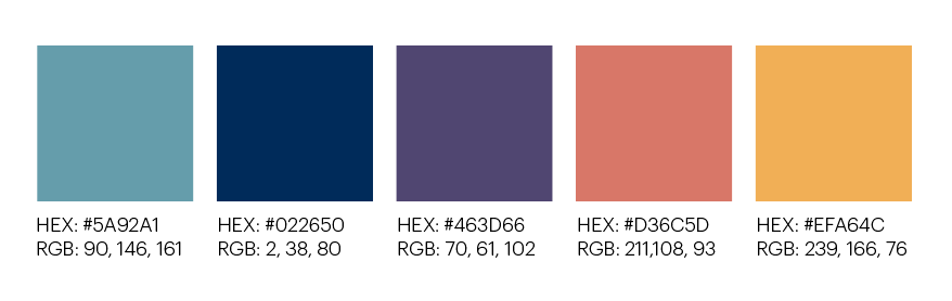
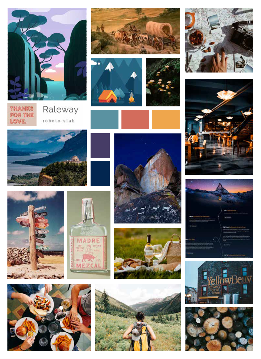
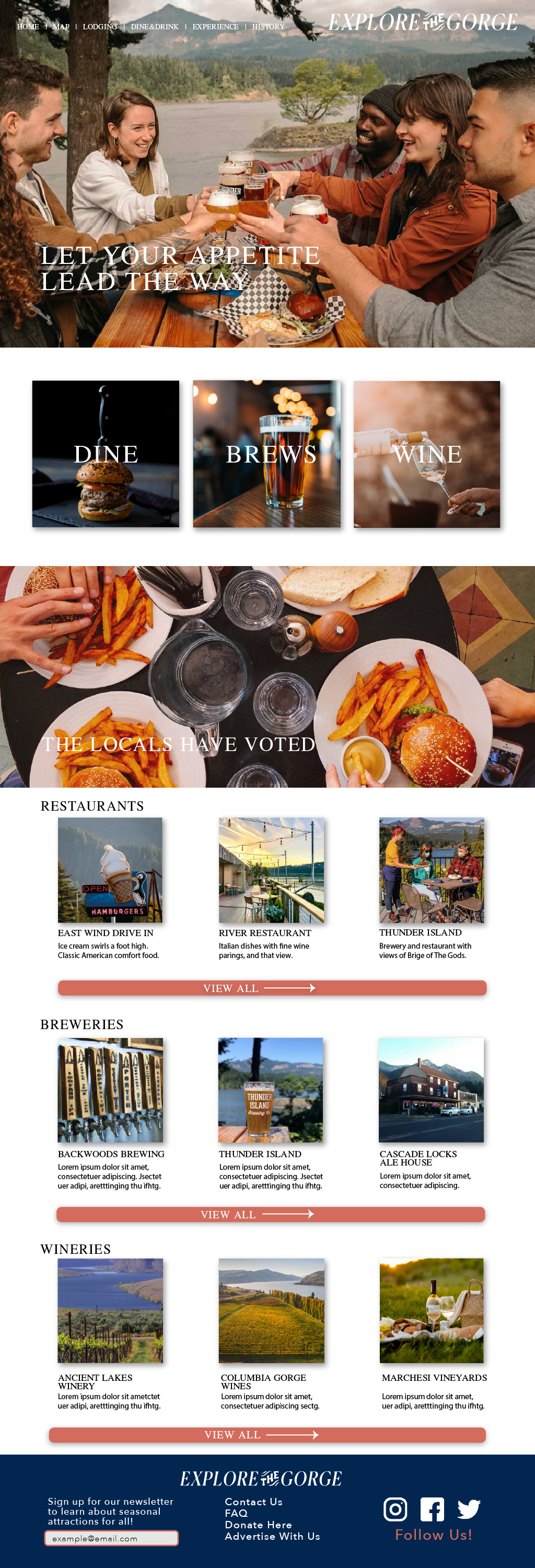
My color choices were directly inspired by the tones and shades on the Gorge. The deep blue and purples are seen in its ruddy waters from high above. While the yellow, orange and light blue make for a dynamic contrast seen between sky and landscape.
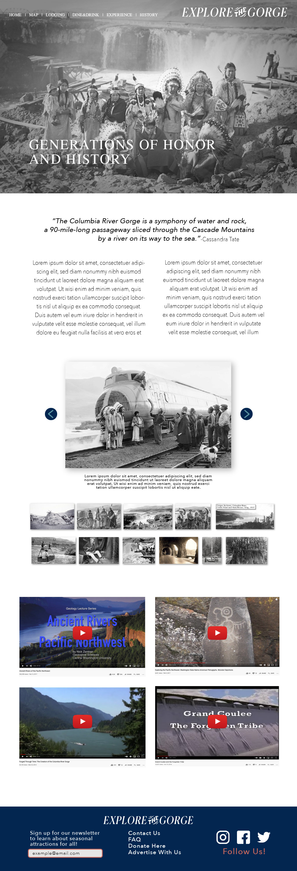
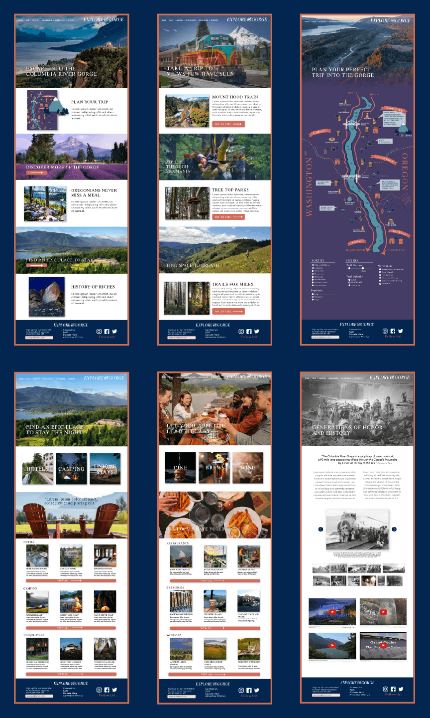
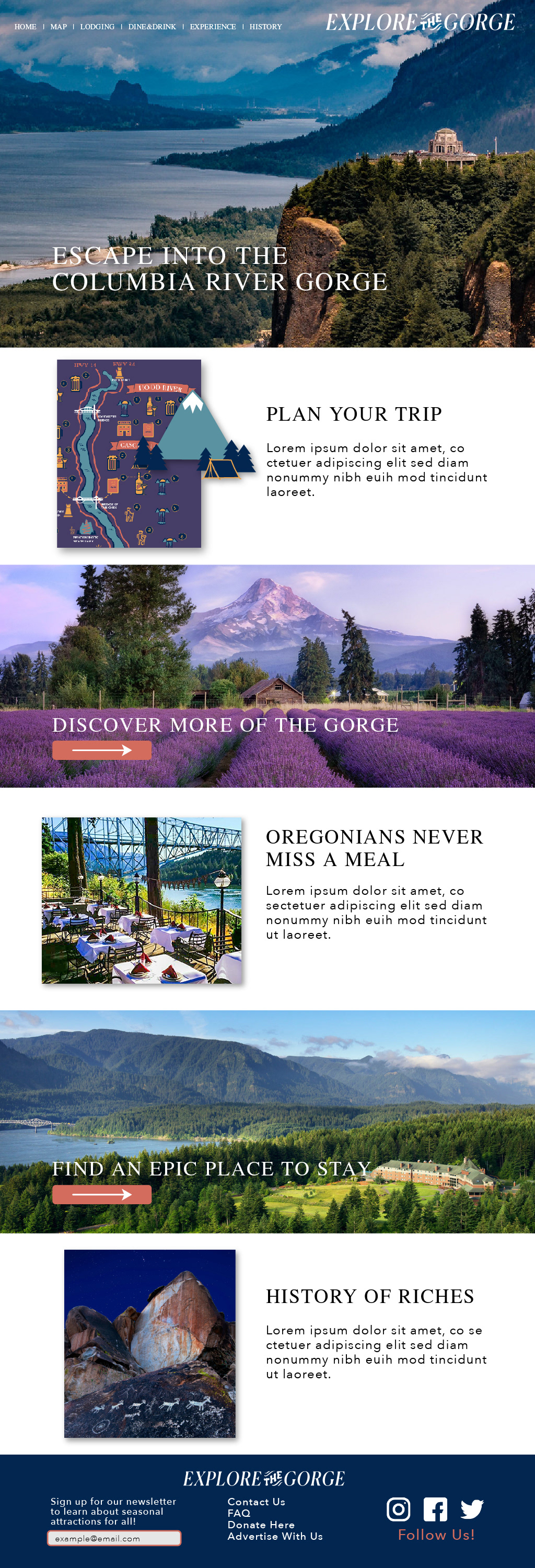
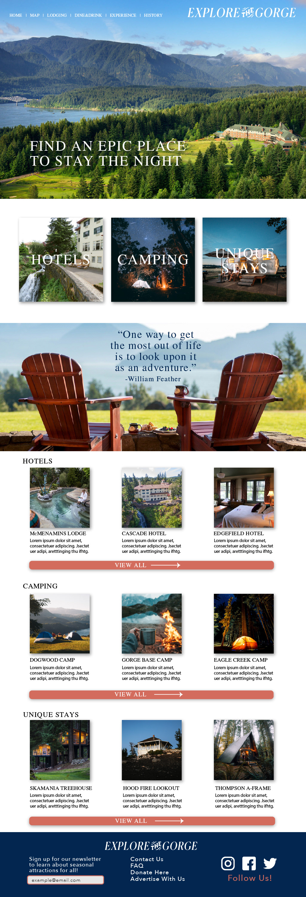
The Explore The Gorge home page is where a visitor can find all that the site has to offer. Each wireframe, except for the map page, begins with an eye catching hero image paired with some bold text to entice the visitor to scroll further down the page. I decided to create a pattern of banner and image card with text down the page to arrange each section of content. The logo and illustrated icons were made by me in Adobe Illustrator. All of the images used throughout the web mockups were from local photographers, made available by Unsplash.com.

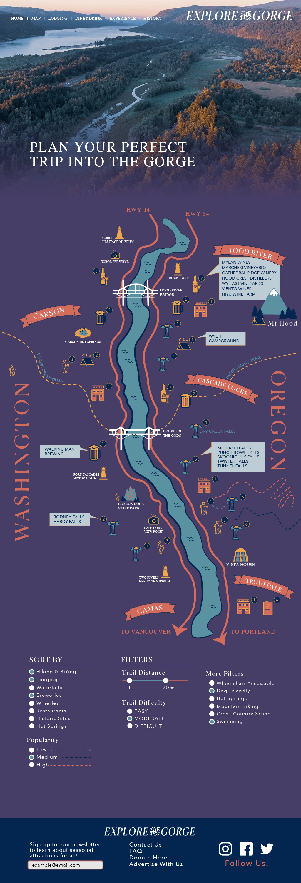
The map page is quite a bit different from the other pages. I used several screen shots of Google map images to construct a basic outline of the terrain and waterway of the Gorge. I created each icon on the map that represent a different attraction on both the Oregon and Washington sides of the Gorge. The attractions include dining, wineries and breweries, lodging, hikes, waterfalls, and historic sites.
The functional concept is for an interactive map where users could filter the map results by searchable items. A user would also be able to hover over an attraction to see the list of options in that area. This map is a great way to show users just how many things there are to do along the Gorge, which would push visitors into less common areas and help build revenue for these communities.
I also built a user journey motion graphic that shows how the map feature could be utilized in an app format. This rendering can be accessed in my body of work on my home page.
The History of the Gorge page was my favorite to create. In my research, I found countless accounts and images of the indigenous tribes that called these waters home long before Lewis and Clark made their way westward. The the Nez Perce Tribe, the Confederated Tribes of the Umatilla Indian Reservation, the Confederated Tribes of the Warm Springs Reservation of Oregon, and the Confederated Tribes and Bands of the Yakama Nation still thrive along these water ways today.